 Catalogue PIGMA
/Physical Environment/Sedimentology Geology/Seabed Nature
Type of resources
Available actions
Topics
Keywords
Provided by
Representation types
Update frequencies
status
Scale
-
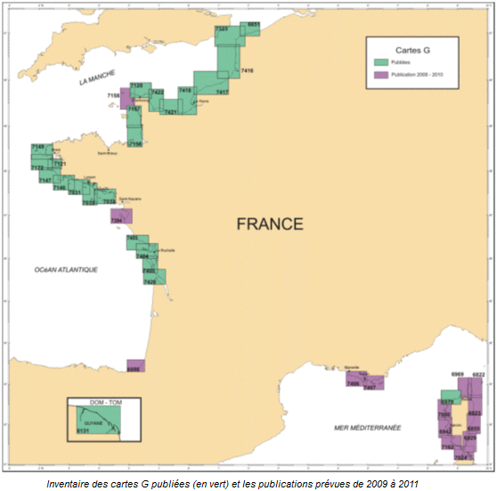
G maps represent the nature of the sea floor in the background of a maritime map used in navigation. Most such maps are published at a scale of nearly 1/50 000, and are as often as possible drawn up within the context of collaborations with university laboratories with knowledge of the area to be mapped.
-
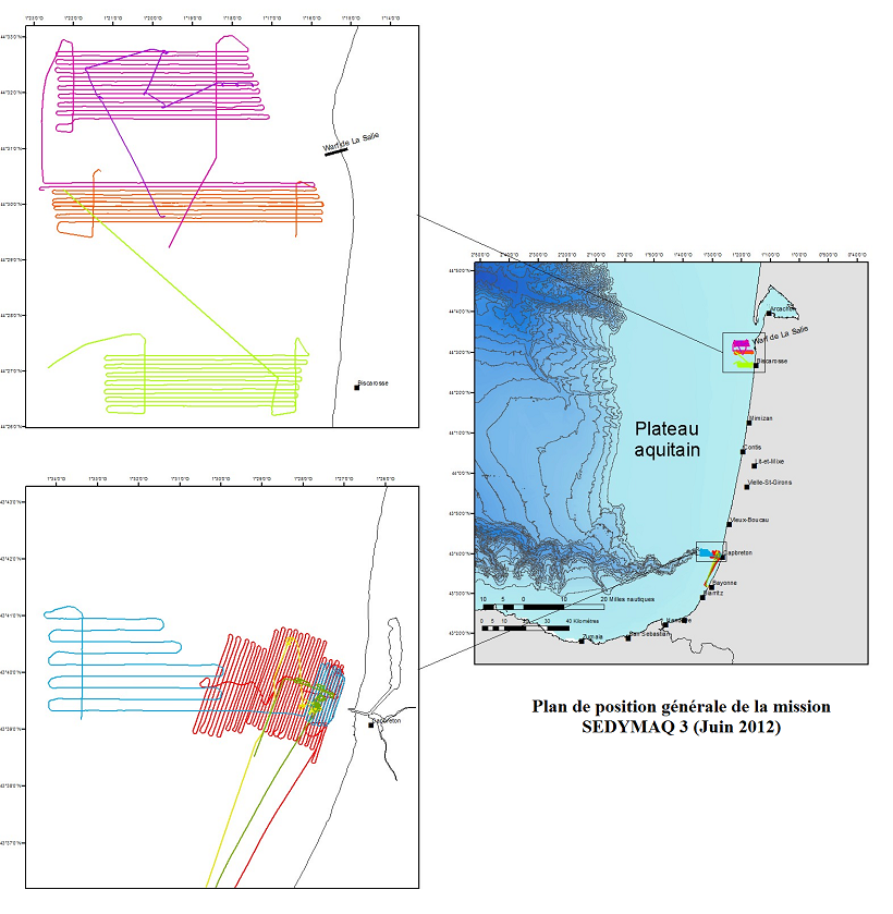
Monitoring the evolution of the Aquitain platform off the coast of the Médoc region (at depths of between 70 and 120 m) and the internal pladeau at la Salie and Truc vert (at depths of between 10 and 40 m) as well as at the head of the Capbreton Canyon (at depths of between 10 and 300m).
-
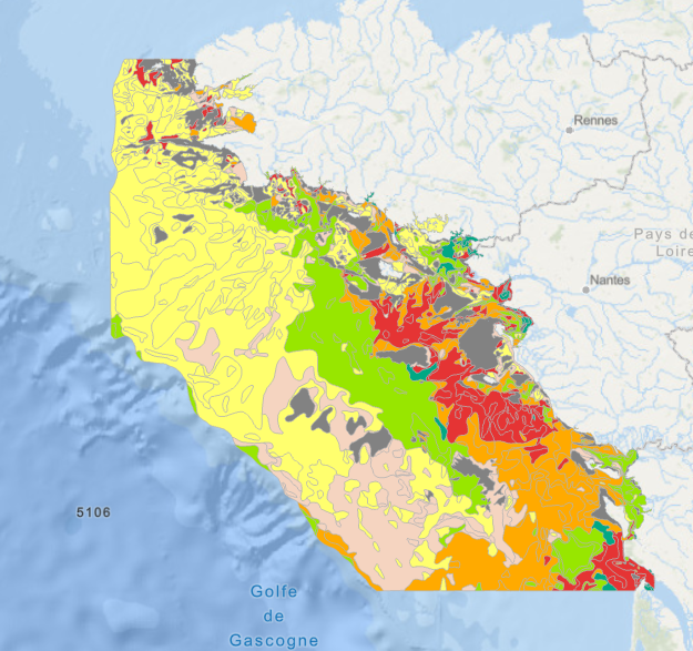
Map of surficial sediments of the northern continental shelf of the Bay of Biscay at 1:500000 by Philippe BOUYSSE, Patrick LESUEUR, André KLINGEBIEL et al., 1986, conducted jointly by the BRGM and Ifremer.
-
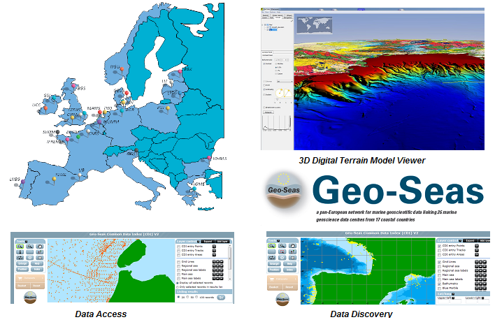
Geo-Seas is Europe-wide infrastructure for managing geological and geophysical marine and ocean data for hydrographic purposes on sites which are of interest to maritime navigation. The current description is limited to making bathymetric data available within the context of the project.